|
February 19th is the deadline for a Washington County Survey asking if we think a new road is needed Around the Mountain and/or a Throughway from Wilsonville through Sherwood to Hillsboro.
175th Neighborhood Association has worked very hard for all of you to get this item onto the Land Use and Transportation Futures Plan, but now we need for the general public to support this in the form of a response to this survey. And to make the statement that we need this SOONER rather than LATER. Please visit the survey website here and select Option 3: "Transportation Choices and Investment Options." The survey takes less than 5 minutes, so make your voice heard and please tell your friends and neighbors! We recommend you review these guidelines to better understand the survey and how to fill it out. There is another new subdivision Application scheduled to be discussed at the February 03 Beaverton Planning Commission. This subdivision looks like 125 single family lots and is not adjacent to 175th …. the traffic has more impact on Scholls Ferry and possibly ultimately on the East-West Collector planned through SCM Heights. See below for the proposed map and website for information if you wish to followup on the details.
http://apps.beavertonoregon.gov/DevelopmentProjects/VicinityMap/RUSSELLPROPERTYSUBDIVISIONVICINITYMAP.pdf http://apps.beavertonoregon.gov/DevelopmentProjects/full_list.aspx FROM THE OREGONIAN – Side note:: The map below doesn't seem to include any area currently in the Hillsboro school district which is likely to be swapped into the Beaverton school district before SCM HS opens in 2017. As a result, the SCM HS district will likely extend further to the west than what is shown. FOCUS ON | School boundary changes BEAVERTON: In preparation for the 2017 opening of its new high school in South Cooper Mountain, Beaverton is realigning the boundaries of all five existing high schools and will move thousands of students to different schools. The district released the preliminary iteration of future high school boundaries Thursday. Whether it changes significantly or slightly is up to a committee of 15 representatives from all five high schools. The Boundary Advisory Committee will spend the next several months weighing enrollment, poverty, proximity, and other demographics before fine tuning the boundaries to balance out, as best as they can, the mix of students at each high school. Ultimately, Superintendent Jeff Rose will decide in the spring whether to accept the committee’s recommendation or make additional changes. The boundary changes will take place at the start of the 2017-18 school year but will not affect that year’s seniors. The district has about 7,800 students in grades 9-11 but not all will be moved. Beaverton High would lose about 75 percent of its existing area. It’s the biggest change of the five high schools, but it does retain the area around Raleigh Park Elementary. The boundary shifts substantially to the north, taking in a large portion of what is currently Sunset High territory and a small section of Westview’s. The boundary would eliminate a long-held partnership with Vose Elementary and Whitford Middle School, said Principal Anne Erwin. “We appear to have one of the greatest community disruptions,” Erwin said, adding that the area around Raleigh Hills and Garden Home have been part of the school for 100 years. Erwin suggested one of the parameters to consider is to better balance the land swaps. “So all of us give and take in equal proportions.” — Wendy Owen 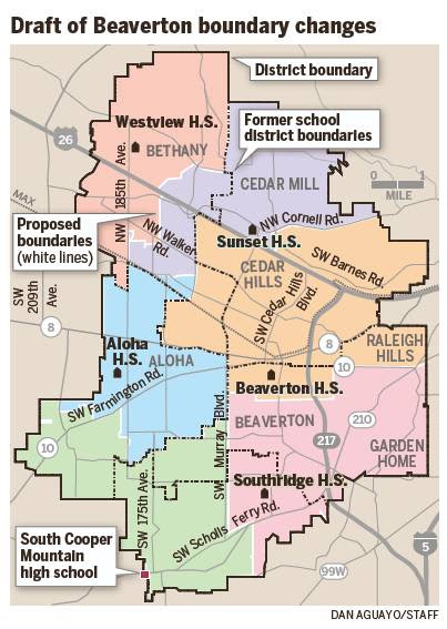 West Hills Development has submitted their application(s) for 384 lot development on 109 acres on north side of SW Scholls Ferry Road, east of SW 175th Avenue, and west of Loon Drive.
PUBLIC HEARING Hearing Date: December 2, 2015 Hearing Body: Planning Commission Mailed written comments to the Commission should be sent to the attention of Sandra Monsalve, Planning Division, PO Box 4755, Beaverton, OR 97076. To be made a part of the staff report, correspondence needs to be received by Friday, November 20, 2015. To follow the official progress of this project see Beaverton City website: http://apps.beavertonoregon.gov/DevelopmentProjects/full_list.aspx#neighbors CLICK ON Neighbors Southwest Scroll down through the Cooper Mountain projects to: South Cooper Mountain Heights CU2015-0006 / DR2015-0071 / LD2015-0013 / TP2015-0008 / ZMA2015-0006 As reported by neighbors on 175th – at 12:30pm on Sunday, 25 October: “The latest crash occurred just a few minutes ago at the very spot the proposed exit for the new development would be emptying on 175th. The car rolled over just across from the fire station. Person was coming north over the second hump, lost control by the dog park, landed on its roof in the ditch right across from the fire station.” Cause of the accident is unknown at this time. As an aside, 175th Neighborhood Association and CPO6 are actively working with the Kemmer Ridge Developers and with Washington County Planners to work out a solution to this access road problem. It is not a “done deal yet.” The Developers have been very open to suggestions and trying to figure out options. We will keep you posted. 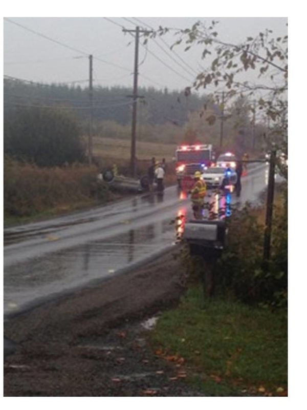 Click here for the updated packet
Noteworthy in this latest packet: * Cleaner map - now we have another engineer on our team who has drawn some road Profile visuals which we feel depict the situation quite well * We have now included 2 of the latest LUT TSP maps (for cars and transit) published online which we have annotated * Our message is consistent: Washington County needs an “Around the Mountain” all-season transportation solution, sooner rather than later Washington County Board of Commissioners has agreed to vacate the old right of way to 175th10/2/2015 An excerpt:
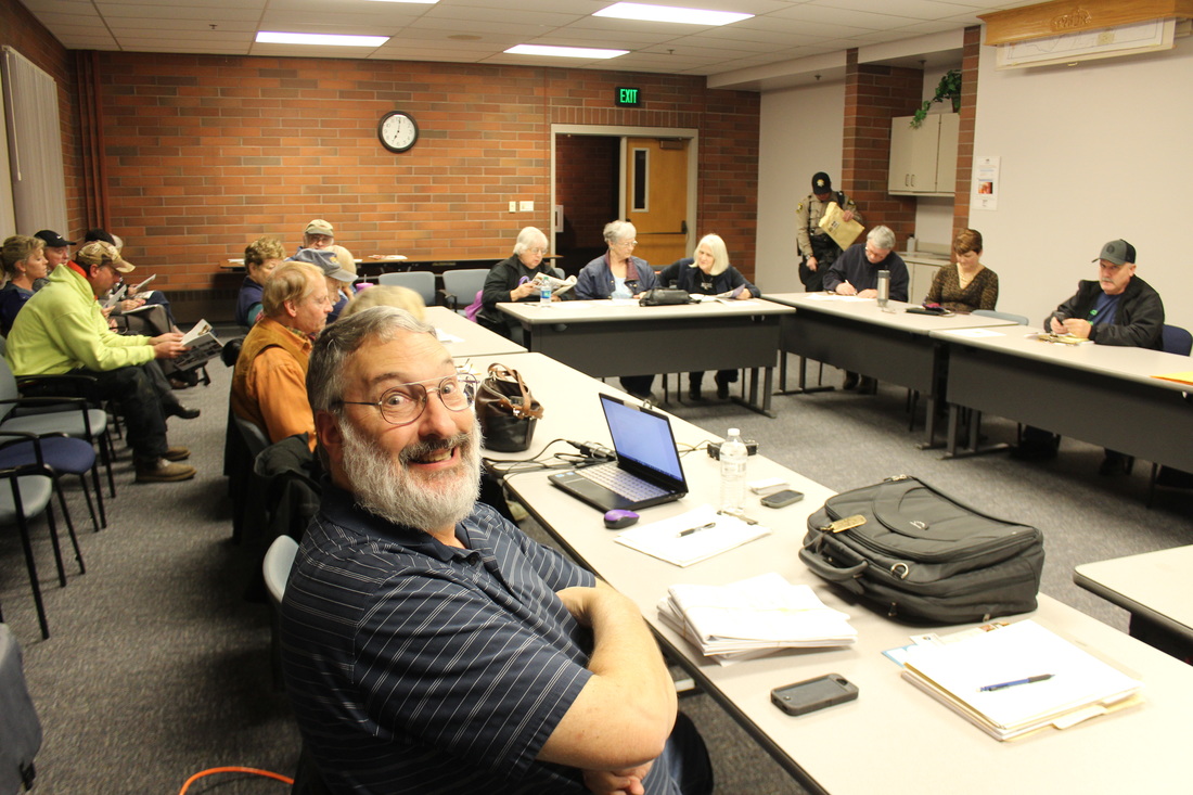
"The portion of SW 175th Place to be vacated falls under Washington County jurisdiction and is entirely within the incorporated area of the City of Beaverton. On September 15, 2015, the Washington County Board of Commissioners found that the proposed vacation will be in the public interest and that the portion of County Road No. 1960 (SW 175th Place) to be vacated is not necessary for future access, provided that the City of Beaverton concurs with their findings." For the full document, see http://beaverton.granicus.com/MetaViewer.php?view_id=2&event_id=630&meta_id=76878 Come hear the latest developments in the Save175th cause. Two identical sessions will be held for maximum attendance and availability of this information. Learn what we've accomplished so far and how you can help!
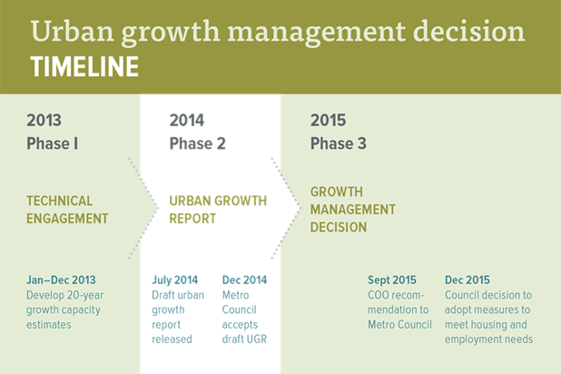
By Elliot Njus The Oregonian/OregonLive Metro’s top manager says there’s no need to make more Portland-area land available for development this year. Martha Bennett, the regional government’s chief operating officer, will recommend that the region’s urban growth boundary not be expanded now. If the Metro Council agrees, it would be the first time the body has voted not to expand the boundary since the current process was put in place in the 1990s. But, Bennett said, the council should revisit its decision in three years rather than waiting the usual six. Critics of the plan have complained that Metro’s growth forecast relies on observations from the beginnings of the economic recovery. As a result, it predicts more new apartments than the historic norm, both in Portland and its suburbs, and fewer single-family houses. But Bennett said the forecast calls for more one- and two-person households than in the past, a trend driven by millennials moving out on their own and baby boomers becoming empty nesters. It also calls for lower median incomes, following a national trend toward low- and high-wage jobs, with fewer in the middle. That possibility has alarmed some people, Bennett said, but “there’s a difference between saying they think the numbers are wrong and ‘we don’t like the pictures the numbers paint,’ ” she said. Legal wrangling over the land available to add to the growth boundary has complicated Metro’s decision. Property owners in Multnomah and Clackamas counties have challenged earlier Metro decisions on urban and rural reserves. Urban reserves are available to be added to the urban growth boundary over the next 50 years, while rural reserves are protected over the same period. Until the reserves are finalized, Metro can’t add land in those counties. “Even if the numbers showed that Metro should expand the urban growth boundary, none of the urban reserve areas in Multnomah or Clackamas counties could be included,” she said.  NOTE (from save175th.org):
 |
Questions?
|
 RSS Feed
